Crown Flight Planner
Plan it before you fly.
An online drone flight planner for building scans, area surveys, orbits and manual waypoints. Shape your route on a full-screen satellite map and see where the camera points at every waypoint.
Try Flight Planner ↗Explore the interactive map in your browser. Check aircraft and export support.
From place to plan
Shape the mission, then inspect the details.
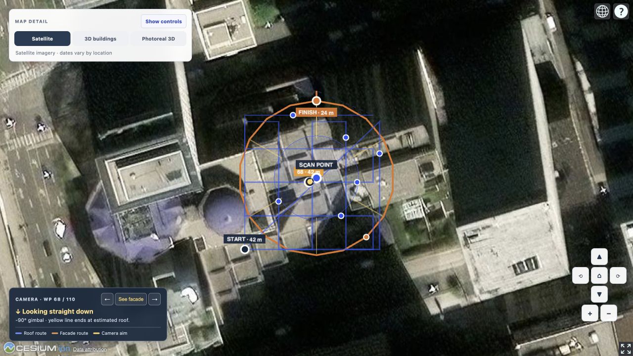
Start with the view you need: a building scan, a 2D area survey, an orbit, or a route you place yourself. The planner draws the path on the map so you can review it before preparing a file.
-
01 / PLACE
Choose a site
Search for a place. Mark a building point for a 3D scan or orbit, trace a survey area, or place manual waypoints.
-
02 / REFINE
Review the camera
Select any waypoint to inspect where it looks. Adjust its altitude, speed or gimbal pitch, or apply a change to all waypoints at once.
-
03 / PREPARE
Check the route
Mark visible site hazards, review route warnings, and name the KMZ before download. Recheck the mission in DJI Fly and at the real site before any flight.
Aircraft support
Plan broadly. Export carefully.
The planner can preview routes for the listed main cameras. A selectable aircraft is not the same as a tested flight file for that controller.
Mavic 4 Pro KMZ export is available. The generated KMZ is checked for the expected structure. It still needs review in DJI Fly before use.
These camera profiles help preview spacing and routes. KMZ export remains disabled until model-specific files and controller imports are verified.
Good to know
Before you take off.
Does the map show every obstacle?
No. Imagery and building data vary by location and can miss new construction, trees, wires and temporary hazards. Inspect the site and follow the applicable flight requirements.
Can I change every waypoint at once?
Yes. Use “Apply to all waypoints” to update altitude, speed or gimbal pitch. Leave a field blank to keep its current values. Review the route again after making changes.
Can every listed drone download a KMZ?
No. KMZ preparation is currently available only for Mavic 4 Pro. The other listed aircraft provide planning previews while their DJI Fly mission files and controller imports are checked.
Ready to explore?